Who We Serve

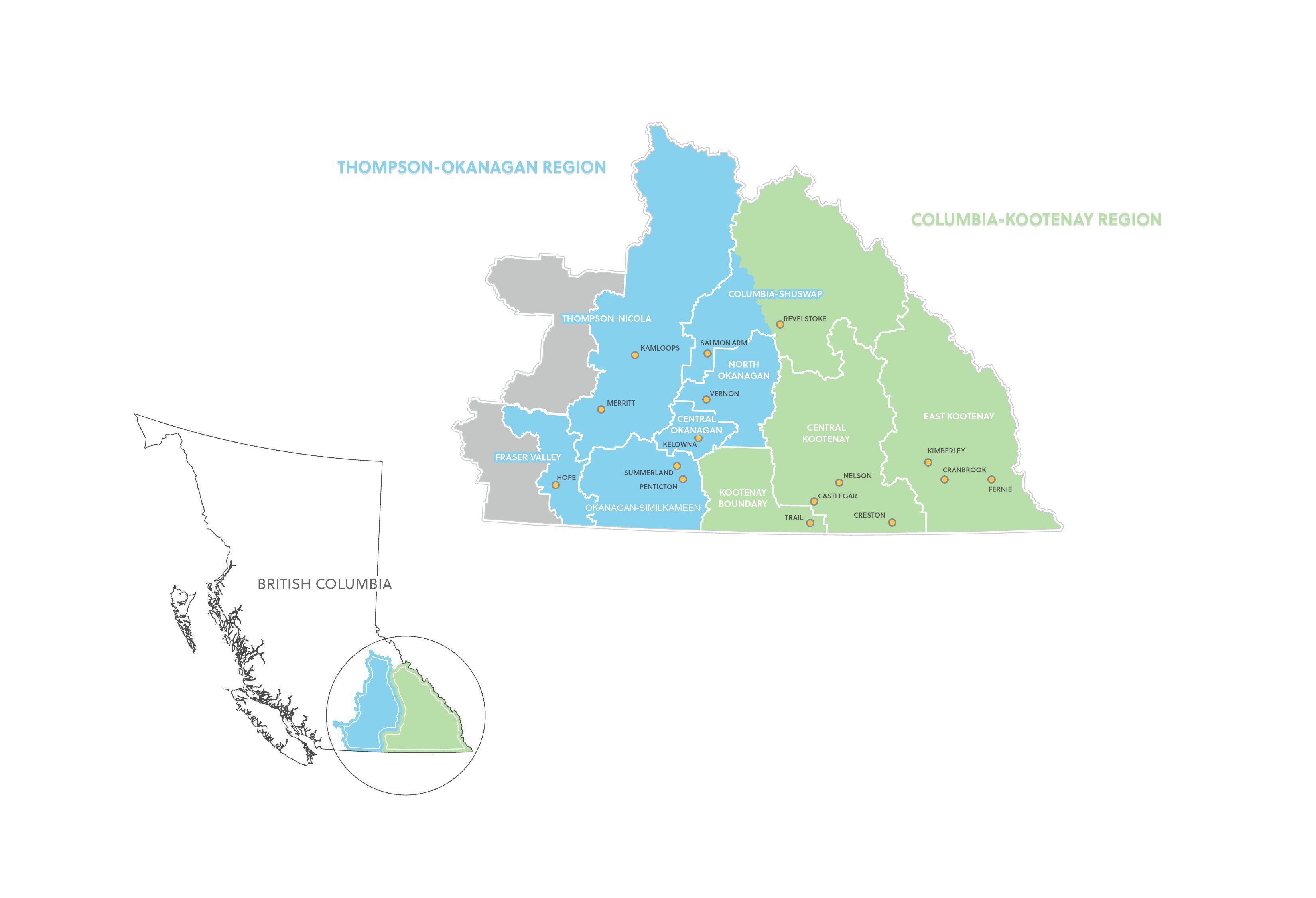
Our service area spans a large and diverse region ranging from Hope to the west, Blue River to the north, the Alberta border to the east, and the US border to the south.

This region, approximately the same area as Ireland and Scotland combined, encompasses 32 First Nations, all or part of 9 Regional Districts, 53 municipalities, and various unincorporated communities, totaling over 758,000 residents.

Approximately half of our residents live in urban areas with populations over 25,000, and the other half reside in rural communities, split fairly evenly across the Thompson-Okanagan and Columbia-Kootenay-Boundary regions.

The ETSI-BC Service Area

Communities Served

Below are the names of the larger communities and First Nations we serve.

THOMPSON-OKANAGAN REGION

Adams Lake
Boothroyd
Boston Bar
Chawathil
Coldwater
Lower Nicola
Lower Similkameen
Neskonlith
Nooaitch
Okanagan
Osoyoos
Penticton
Peters
Shxw’ow’hamel
Simpcw
Skawahlook
Skeetchestn
Skwlax te Secwepemculecw (Little Shuswap)
Splatsin
Spuzzum
Tk’emlúps te Secwépemc
Union Bar
Upper Nicola
Upper Simalkameen
Westbank
Whispering Pines/Clinton Band
Yale

Falkland
Salmon Arm
Sicamous
Area C, D, E, F, G

Hope
Electoral Areas A & B

Armstrong
Coldstream
Enderby
Lumby
Spallumcheen
Vernon

Cawston
Keremeos
Okanagan Falls (expected incorporation in 2025)
Oliver
Osoyoos
Penticton
Princeton
Summerland

Barriere
Chase
Clearwater
Kamloops
Merritt
Sun Peaks Mountain Resort
Electoral Areas A, B, J, L, M, N, O & P

Kelowna
West Kelowna
Lake Country
Peachland
West Electoral Area
East Electoral Area

COLUMBIA-KOOTENAY REGION

ʔakisq’nuk
ʔaqam
Shuswap
Syilx
Yaqan Nuʔkiy
Yaq’it ʔa·knuqⱡi ‘it

Golden
Revelstoke
Area A & B

Canal Flats
Cranbrook
Elkford
Fernie
Invermere
Kimberley
Radium Hot Springs
Sparwood

Castlegar
Creston
Kaslo
Nakusp
Nelson
New Denver
Salmo
Silverton
Slocan

Fruitvale
Grand Forks
Greenwood
Midway
Montrose
Rossland
Trail
Warfield